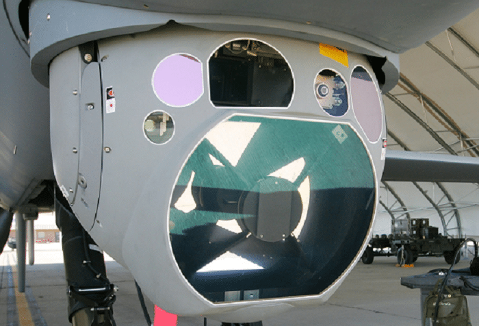
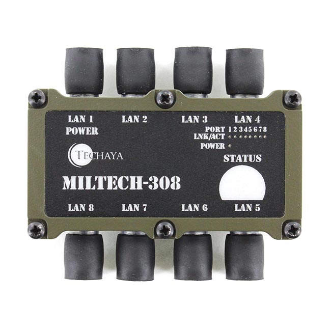
As the leading provider of ultra-compact Ethernet switches, we are often specified in to environments that are often labeled as “sensor pods”. Since the term “sensor” seems so generic, I thought I’d do a little research on what some these sensor technologies are and what were some of their applications . As I was investigating their applications, I found that several of the military uses are quickly making it to commercial applications.
1) Hyperspacial Sensors. These sensors use reflections from hundreds of bands in the infrared range of the electromagnetic spectrum. We all understand that cameras and eyeballs use UV to identify targets by their shape or by contrasts of light and dark. Well, hyperspectral scanners use reflections of various IR wavelengths to determine the material that a target is made of. Every object has its own unique “fingerprint” and hyperspacial sensors collect the data and help match it up to those “fingerprints”. Today, military applications of hyperspacial sensors include detecting roadside bombs and fields of illegal drugs such poppies for opium.
In the future, non-military applications of hyperspacial sensors could include assisting police forces hunting for unmarked graves or looking for illegal drug crops that are planted within other crops. Civilian applications of might include mineral detection for mining and legal farm crop maintenance.
2) Wide Area Surveillance. Imagine over 350 iPhone cameras on megapixel steroids all shooting the same terrain at once. This is the basic premise behind wide area surveillance. Hundreds of powerful imaging sensors can take simultaneous images of an area the size of a small city. With 274 terabytes of data collected each day and all of that data accessible, operators can zoom in on any particular object down to six inches in size. Current military applications include deploying these systems on blimps and UAVs to track cities and areas that might be in the middle of military activity.
As the technology is developed, wide area surveillance could be launched on blimps, UAVs or satellites and be available for law enforcement to “turn on” in situations where possible criminal activity could be taking place. For traffic monitoring, these sensor are so powerful that wide area surveillance could track vehicles that are going above the speed limit, hone in on the auto’s license plate and give the data to law enforcement agencies to issue citations.
3) Multi-spectral Targeting Systems. A combination of infrared sensors, a color/monochrome daylight TV camera, and an image-intensified TV camera, Multi-spectral Targeting Systems (MTS) allows video from individual sensors to be viewed or can combine all of the images from multiple sensors in to one large image. It permits long-range surveillance and high-altitude acquisition, tracking and laser designation for surveillance, target acquisition, tracking, and range finding. The results are detailed images that can be created from airborne vehicles that are so high in altitude that they can’t be detected from the ground. MTS systems are already deployed in 50+ military and Homeland Security platforms.
MTS could be useful for law enforcement agencies, yet it produces so many hours of video that until more efficient video processing and viewing platforms are produced, it would probably only be used for “on-demand” applications such as monitoring events, natural disasters and search and rescue.
4) Light Detection and Ranging (LIDAR). A remote sensing technology that measures distance by illuminating a target with a laser and analyzing the reflected light, LIDAR is the a technology most commonly used to make high-resolution maps. Today LIDAR is used for mapping the terrain of areas of conflict to help better prepare our troops for the battlefield. The US Navy is also using LIDAR-equipped Firescouts to detect pirates in open waters.
LIDAR is an already widely used technology for applications such as geomatics, archaeology, geography, geology, geomorphology, seismology, forestry, remote sensing, and atmospheric physics.
Sensing technology gives us endless possibilities for detection, monitoring, surveillance, mapping and hundreds of other applications. What is certain, however is that all of these sensors and technologies will need three key ingredients to support their applications: Ethernet and Ethernet switches to connect these sensors to each other or other compute devices; data storage for the billions of Terabytes of data that is generated; and wireless communication to get that data back to central command.
Here at MilSource, we’ve got the Ethernet switches covered. As the exclusive distributor of Techaya Ethernet switches, we’re leading the industry in the size, weight and power (SWaP) that these small, lightweight UAV’s need. For now, we’ll leave the storage and wireless up to other folks in the industry.


